Crop insurers adopt satellite remote sensing technology to monitor crop progress
Technology offered by EarthDaily Agro brings speed and precision in monitoring insured properties, amid the Covid-19 pandemic
Crop producers in all regions of Brazil purchased more than 193,000 crop insurance policies last year covering 13.7 million hectares. This represents about 21% of Brazil’s total farming area according to the Ministry of Agriculture, Livestock and Supply (MAPA). The total crop value insured by producers totalled R$45.7 billion, 108% higher than in 2019. Facing more frequent severe weather events each year, there is a growing trend is among crop producers to continue insuring more hectares in the future.
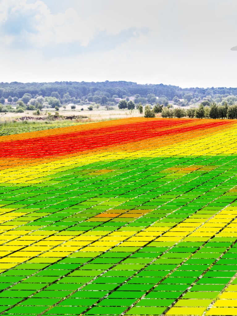
Remote sensing, via satellite, provides data to help minimize the risks of losses in agricultural crops. These analyses primarily help agricultural insurers, who combine the information mapped by satellites with field work for detailed monitoring of the insured areas. “Faced with the challenge of the pandemic, which restricted field work, coverage with satellite image data has become a fundamental tool in evaluating crop losses and risks associated with extreme climatic events,” explains the agricultural engineer and commercial manager of EarthDaily Agro Brazil, Gustavo Libardi.
In the final stretch of the 2020/2021 summer harvest, Brazil should harvest around 132 million tons of soybeans. Following that, the planting of safrinha corn will begin, with an estimated production of almost 80 million tons. These and other crops are subject to the most diverse climatic problems throughout the different stages of the crop cycle.
The analyses of the planted areas made by EarthDaily Agro are integrated as key components of the underwriting process, i.e. in the closing of the contract made by the producer with the agricultural insurer. “When a producer applies for insurance, analyses are performed on the property to determine compliance with guidelines related to the previous production history of the agricultural area and environmental requirements. With the information obtained by remote sensing, mapped by satellites, agricultural insurers are able to pre-approve certain coverages without the need for an in-person visit. This speed and accuracy of data have been fundamental for the closing of rural insurance contracts. In addition, the anticipation of risk factors to the insured crops allows farmers to make more confident decisions in the management of the crop”, says Libardi.
In the 2020/2021 crop year, dry weather affected soybean production in Rio Grande do Sul, reinforcing the importance of agricultural insurance as an important tool to protect against losses. “We are able to map from large areas to the square meter. We monitor the evolution of crops on a daily basis using indicators that show the vegetative vigour of the plants, soil moisture and climatic events. This analysis can be made for just the insured fields, in the surrounding area, at the state level, and throughout Brazil and other agricultural countries in real-time”, explains the manager.
Another feature that broadens the value even more for satellite-generated data technology is parametric insurance, which came into force last January and is still a new concept for the market. Parametric insurance uses a pre-determined index in the contract as a parameter for determining the occurrence of climate problems. The policy coverage is triggered if the index used as parameter is reached, as opposed to the actual crop health. An example of this was the drought recorded in the south of the country. If the base index for minimum rainfall established in the agreement between the producer and the insurer was not reached, the insurance coverage was triggered.
The Ministry of Agriculture has regulated the parametric insurance with a 20% subsidy to the premium, for any activity, and should become a great alternative for rural protection in the next crops, since it allows the producer to adopt a coverage for the agricultural area in the way that is most important for their crops.
Today, EarthDaily Agro Brazil monitors about 20 million hectares of agricultural areas in the world and delivers to customers, daily, 200,000 maps with remote sensing data generated through satellite mapping.